Louisiana Geological Survey
Welcome to Louisiana Geological Survey
The Louisiana Geological Survey is Louisiana’s official geological survey, established by the Legislature in 1934 and reaffirmed under Louisiana Revised Statute 17:1492 as a research unit of LSU. As a core component of the LSU Energy Institute, the Survey provides foundational geoscience data and analysis to support responsible natural resource development, environmental stewardship, and informed policy and planning across the state.
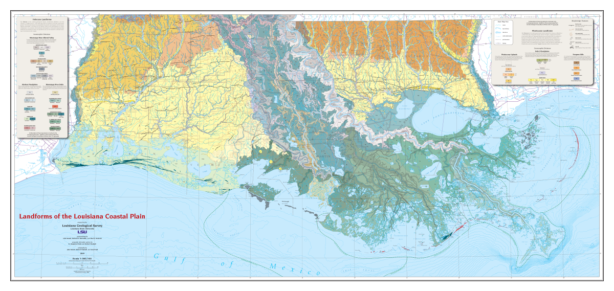
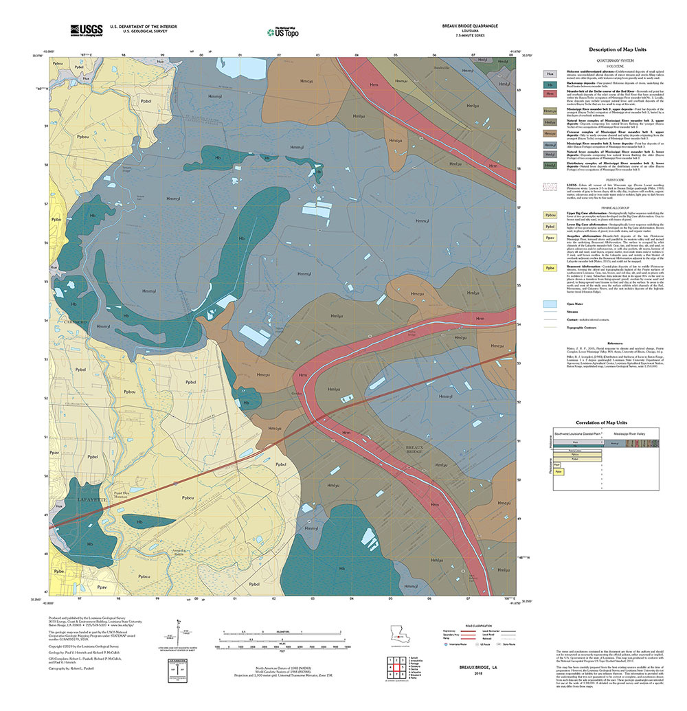
LGS scientists map and interpret Louisiana’s surface and subsurface geology; maintain extensive well log, core, and digital data libraries; and produce maps, publications, and decision-support tools that serve state and local agencies, industry, researchers, educators, and the public. This work underpins land-use planning, energy and mineral resource assessment, water and coastal management, hazard mitigation, and broad geoscience education and outreach throughout Louisiana.
LGS Well Log and Core Repository
Well Log and Core Repository
LGS has an extensive collection of over 50,000 well logs for Louisiana and core samples from over 400 wells in the Gulf Coast states. Founded in 1982, our climate-controlled facility houses samples from the Smackover and Wilcox Formations and serves as the only resource center of its kind in Louisiana. Available for use by industry, academia, and government agencies.
Explore Our Data & Resources
The Louisiana Geological Survey collects, curates, analyzes, and disseminates high-quality geological data to support land-use planning, infrastructure development, environmental analysis, water resources, coastal processes, and scientific research across Louisiana.

The Louisiana Geological Survey operates as a core component of the LSU Energy Institute, contributing foundational geoscientific information to support energy research, policy analysis, and informed decision-making across Louisiana.
LGS News
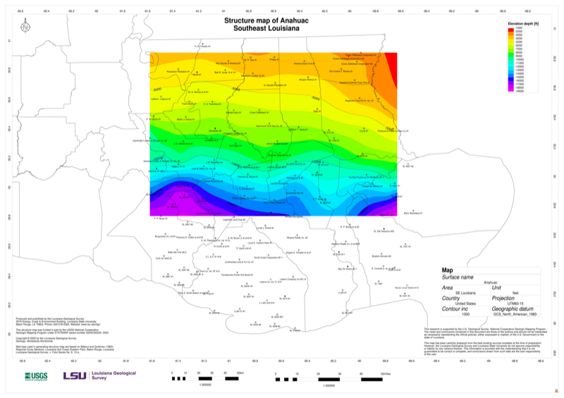
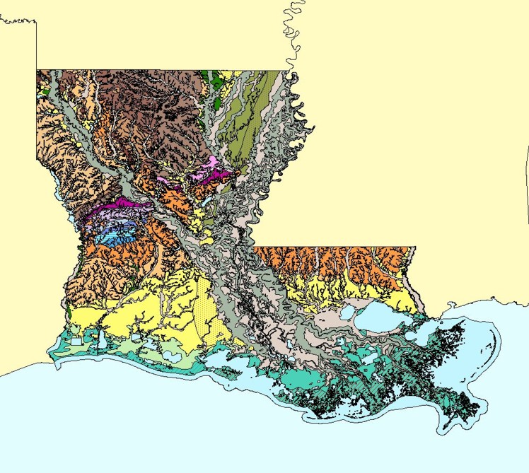
The Louisiana Geological Survey (LGS) has developed new digital structure maps for several important geologic intervals and formations across the state. The maps include the Lower Miocene, Middle Miocene, and Upper Miocene intervals, as well as major geologic formations.
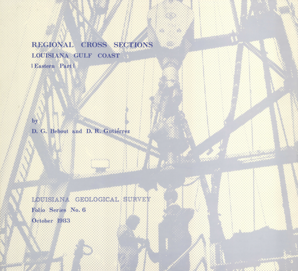
The Louisiana Geological Survey has completed digitization of Bebout and Gutiérrez's 1983 Regional Cross-Sections of the Louisiana Gulf Coast (Eastern Part) as part of the 2024–2025 STATEMAP project funded by the USGS and State of Louisiana.